History of Flint Pen Strand: Part One

photo by Michael Lund

Flint Pen Strand becomes part of the CREW Project

Volunteer Perspective Series

By Nan Mattingly

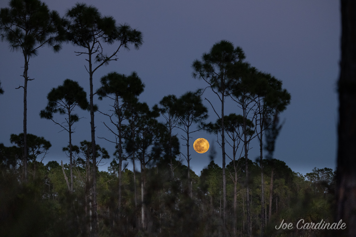
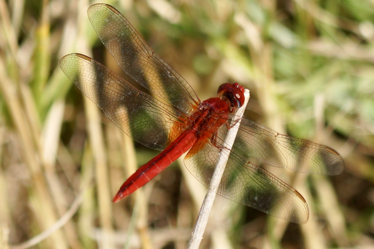
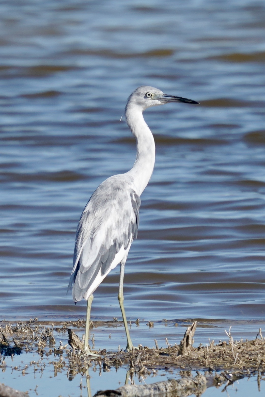
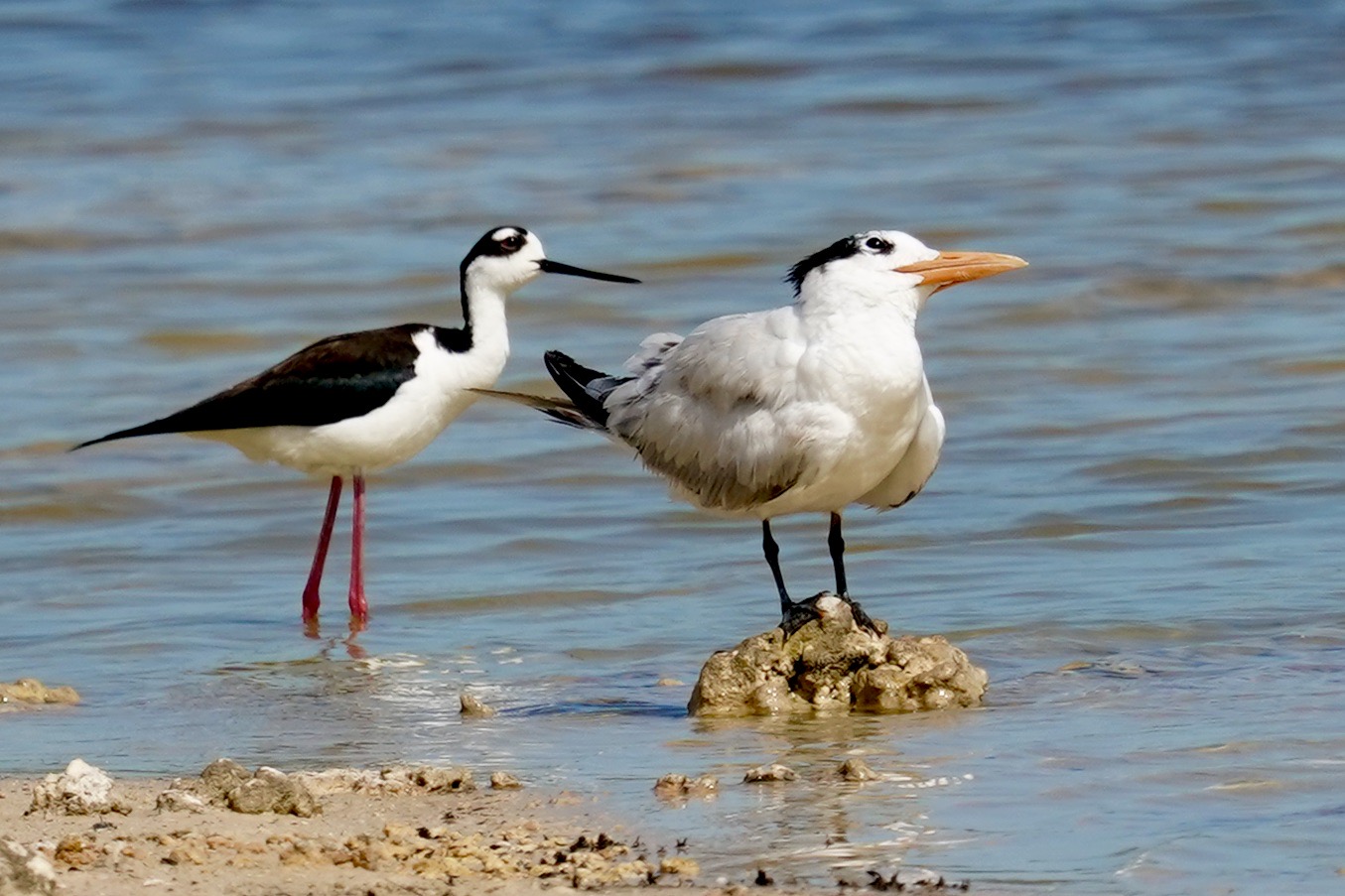
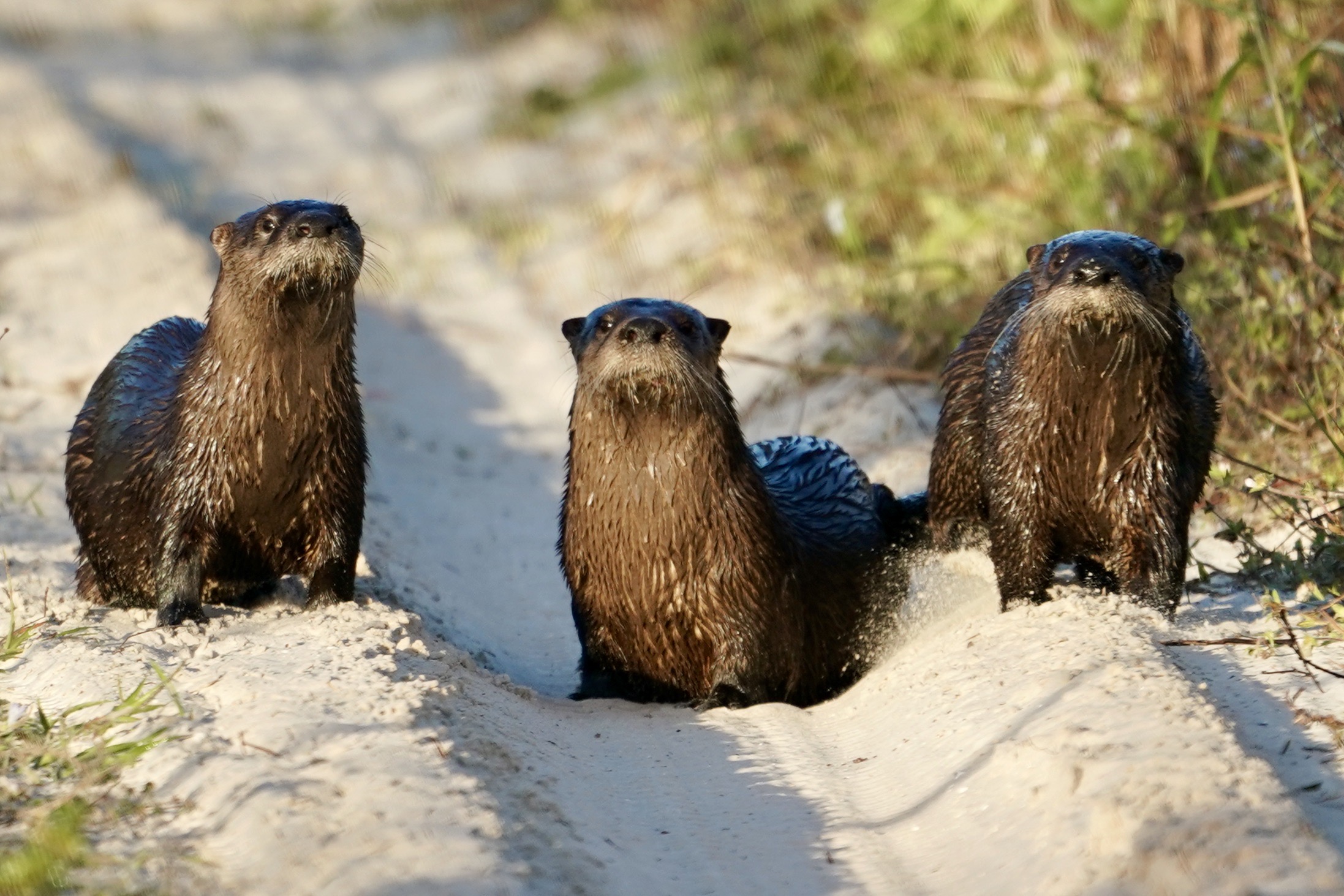
Have you hiked the trails of CREW Flint Pen Strand (FPS) yet? Seen a pair of ospreys fly overhead and heard their distinctive call? Enjoyed the serenity of walking alongside the Kehl Canal on the red trail? Watched the antics of shorebirds along the lakes on the eastern side? Identified any of the colorful wildflowers that grow throughout the 14,000-acre property?

If so, you and many hikers, equestrians, bicyclists, hunters, photographers, dog walkers and nature lovers owe a big thanks to the people, organizations and local and state governments who cooperated to acquire the land, restore its natural ability to collect and purify water to replenish the aquifers and develop the trails that we now enjoy.

To encourage you and your family to discover the beauty of FPS, we’ve written a series of blogs to tell you a little about the background of the establishment of FPS as part of the Corkscrew Regional Ecosystem Watershed (CREW) Project, the historical use of the land and the restoration of its wetlands.

Dwarf Cypress trees on the Yellow Trail North at Flint Pen Strand

The area now known as CREW Flint Pen Strand was, in the late twentieth century, a flat and flood-prone area. At that time, the land was in the beginning stages of development for single-family homes on five- to ten-acre plots. A small part of the land was already inhabited and was being used for pasture, row crops and other agricultural activities, and a mobile home park was situated within its boundaries.

But local officials, environmentalists and residents recognized that development was affecting surface water storage and the natural flow of water from the Lake Trafford area through Lee and Collier County and into the Imperial and Cocohatchee Rivers. Bonita Springs was experiencing increased flooding and contamination of surface and ground waters. After a great deal of tangling with red tape, many community hearings and various assessments, it was decided that it was critical to halt development and restore the ecosystem of the land to improve water quality and supply, reduce the threat of flooding and improve habitat for protected species and other wildlife.

Flint Pen Strand during the rainy season

Water quality testing at that time had revealed the undesirable effects of agricultural and residential use of the land. These activities added pollutants to the water and decreased the time that water could linger on the land, reducing the amount of water that seeped into the aquifer. This finding made the restoration project more urgent. 

An environmental assessment performed, as a part of the larger project by the U.S. Army Corps of Engineers in 1999, found that the restoration of FPS wetlands would reclaim habitat needed by several species, including wood storks, an endangered species at that time (now classified as threatened). Wood storks have extremely specific foraging requirements, and FPS promised to provide their essential needs for nesting and feeding. Consideration was also given to the Florida panther, its need for space to roam, and the numerous other species protected within their range, as well as the Florida black bear and the Big Cypress fox squirrel. The project also would aim to remove much of the exotic vegetation that had invaded the land, primarily melaleuca trees and Brazilian pepper bushes.   

Woodstorks and numerous other wading birds at Flint Pen Strand, November of 2019

In short, restoration of FPS promised considerable benefits for wildlife, vegetation and people.

If you look at a map of the CREW Project as it now exists, you’ll see that FPS is a key part of the project, adjoining CREW Bird Rookery Swamp and buffering Corkscrew Swamp Sanctuary. FPS comprises a large part of the 60,000-acre CREW Project. More importantly, FPS has become a key part of the protection of the 3-aquifers underlying the CREW Project – the aquifers that provide much of the drinking and general use water for southern Lee County and northern Collier County. The ongoing restoration of the wetlands and the landscape of FPS is now transforming this environmentally valuable property into a place that everyone can enjoy – a place that allows birds and many species to call it home and that will help keep us all supplied with drinking water.     

And if you want to see some evidence of whether or not this ambitious restoration project has achieved any of its goals, check out the weekly volunteer observation reports by a CREW Trust volunteer who records the type and number of species he encounters in his lengthy trail walks. Those observations are posted on the CREW Land & Water Trust Facebook page (@CREWTrust). Additionally, if you walk the Red Trail, you’ll find an area that some call the melaleuca graveyard. A lot of work by the South Florida Water Management District (SFWMD) has gone into the effort to kill those invasive trees that threaten native species. That work continues.  Keep an eye out for the next post in this series – it may surprise you, to learn who the earliest users of FPS lands and resources were and how they traveled to get there.

CREW and You, part 4: WHERE

Map of CREW

This is part 4 of a 6-part series on the Who, What, When, Where, Why and How of the CREW Land & Water Trust.

Map of CREW
The CREW Project

It’s pretty often that we get a phone call at our office and someone says, “Where are you located?” or “Where is the trail?”

So let’s cover that today.

WHERE, exactly, is the CREW Land & Water Trust located?

At a field station. A super, top-secret field station, with radiactive sandhill cranes that guard the entrance. (Just kidding about all of that except for the field station part.)

The CREW Trust shares an office with two of our partners in the CREW Project – South Florida Water Management District and Florida Fish & Wildlife Conservation Commission. Because this is a shared office, and we have no trails (really, none – it’s very boring), we use our address for mail only. If you do look us up on Google maps based on our mailing address, we appear to be somewhere in the middle of some strange fields off of Corkscrew Road.

Basically, where WE are isn’t as important as where the CREW Project is.

The CREW Project is a 60,000-acre watershed that spans Lee and Collier Counties. There are four trail systems that are open to the public for various recreation opportunities.

The CREW Trail Systems: A – CREW Marsh Trails; B – Cypress Dome Trails; C – Bird Rookery Swamp; and now a trail has opened in Flint Pen Strand.

The CREW Marsh Trails (4600 CR 850 (Corkscrew Road), Immokalee, FL 34142 ) were the first trails to open within the CREW Project and feature 5.5 miles of looped trails. The trails are located in Collier County and meander through pine flatwoods, sawgrass marsh, oak hammock and popash slough ecosystems.

The Cypress Dome Trails & Caracara Prairie Preserve (3980 CR 850 (Corkscrew Road), Immokalee, FL 34142) are located in Collier County near the Lee County border. The Cypress Dome Trails offer 6 miles of looped trails and connect to the Caracara Prairier Preserve, which is owned and managed by Conservation Collier.

Bird Rookery Swamp Trail (1295 Shady Hollow Boulevard, Naples, FL 34120) is an approximately 12 mile trail located in Collier County. The trail features a shell path, short boardwalk and grassy tram – a remnant of its logging history.

The first trail in Flint Pen Strand opened in November 2018 and more are in development. The 1.5-mile red trail offers views of the Kehl Canal along with sections of seasonal marsh and hydric pine.

Board of Trustees meeting

The CREW Land & Water Trust will hold its Board of Trustees meeting Friday, January 23, 2015 from 9:00 AM to noon at the Estero Community Center, 9200 Corkscrew Palms Blvd., Estero, FL  33928.

CREW Trust members and other interested parties are welcome to attend. Come out and learn more about your local community.  The full CREW Trust Board only meets three times per year.

people at a trustee meeting
Trustee Meeting

Lost Grove Mine Application Closed

Post by Brenda Brooks, Executive Director, CREW Land & Water Trust 

CREW Marsh Trailhead signYou may recall that Alico Land Development was seeking approval from Collier County for development and operation of the Lost Grove Mine. The mine was to be located directly across Corkscrew Road from the CREW Marsh Trails.  Since 2011, there have been many panel discussions, neighborhood information meetings and public hearings on the proposed 1,383-acre mine. The CREW Land & Water Trust participated in many of these meetings due to our concerns with the mine’s impact on CREW.

Lost Grove Mine Location Map

We just received an update that Collier County has closed the Lost Grove Mine application due to inactivity of the applicant. At this time if Alico Land Development decides to move forward with this proposed mine, they will be required to submit a new application and begin the process all over again.

We will continue to update you if we get any additional news on the Lost Grove Mine.

Until then, come on out to the trails and enjoy a hike in this beautiful weather.

Flint Pen Strand

Cypress trees in Flint Pen StrandFlint Pen Strand and Southern Critical CREW are the Lee County portions of the CREW project, located north of Bonita Beach Road (east of I-75) and south of Corkscrew Road.

This portion of CREW currently has no officially marked trails and no recreation facilities, except for a hunter check station located at Poor Man’s Pass. The South Florida Water Management District is still working on restoration of sheet flow and exotic species control and removal here. Recreation plans are forthcoming, and include hiking trails, horseback riding, and campsites. Currently, hunting is allowed in part of Flint Pen Strand under the Florida Fish and Wildlife Commission’s regulations for the CREW WEA (Wildlife & Environmental Area).

The whole CREW project map

As the restoration process progresses, we will keep you  posted on recreation plans s they become available…